
Sxwtpqyen Area Transportation Special Impact Fee
Consultation has concluded
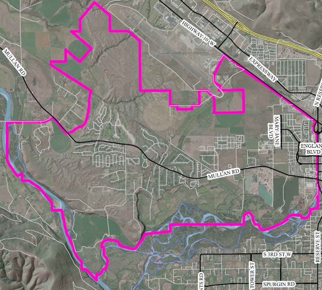
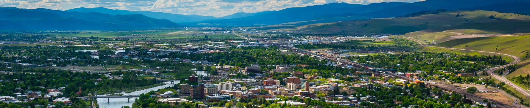
The Public Works & Mobility Department is seeking public feedback on and would like to answer questions about the transportation special impact fee for new development in the Sxwtpqyen (Sooh-tup-CANE) Area, which is generally the Mullan Road area west of Reserve Street and south of Broadway. Please use the tab at the bottom of this page for comments and questions.
A public hearing for the proposed fee was held on February 22, 2021, when the Missoula City Council accepted public comment. The fee was adopted by City Council on March 1, 2021, and went into effect March 31, 2021, per Resolution 8502.
Background
The City of Missoula, in partnership with Missoula County, intends to construct transportation improvements and public utility improvements with a federal Better Utilizing Investments to Leverage Development (BUILD) Grant and other local funding sources included in the Mullan BUILD Project; however, the federal BUILD Grant and other existing local funding sources will only cover about 50% of the cost of the project. The City intends to fund the remainder of the cost of the project through transportation impact fees and utility development fees applied to new development in the Sxwtpqyen Area, which benefits from the Mullan BUILD Project.
The proposed fees will equitably assess the cost of infrastructure necessary to support the high-quality, sustainable development envisioned in the Sxwtpqyen Neighborhoods Master Plan. New roads and utilities are typically constructed by developers, but the BUILD grant allows the City and County to construct key infrastructure improvements ahead of development, lowering the overall cost to developers. Since the BUILD grant did not cover the entire cost of the improvements, the new fees will be used to make up the difference. By proactively constructing new roads and utilities, the City and County can better plan for growth, avoid piecemeal construction, reduce overall costs, and mitigate the impacts of development on existing residents.
Origin of the Sxwtpqyen Name
A brief explanation of the name's origin is presented in the revised Sxwtpqyen Neighborhoods Master Plan as follows:
"Looking south of the planning area one can see a line of trees in the distance along the north side of Nmesulétkʷ (the "middle" Clark Fork River). Prior to development, this riparian forest stood in sharp contrast to the surrounding grasslands. It was wedge-shaped, wider in the west and gradually tapering to a point in the east, somewhere in the vicinity of present-day Reserve Street. In Salish, this part of the valley is called Sxʷtpqyen, meaning 'Place Where Something is Cut Off and Comes to a Point.' In rough phonetic spelling using English characters, this name could be represented as 'Sooh-tup-CANE.'"
The Confederated Salish-Kootenai Tribes of the Flathead Nation's Tribal Council recommended the name to project planners, and it was adopted by both the Missoula City Council and the Missoula Board of County Commissioners.
Transportation Projects
Impact fee revenue can only be used to fund these specific projects:
Project | Total Cost |
| Mary Jane Boulevard South | $4,524,000 |
| Mary Jane Boulevard North | $5,319,000 |
| Flynn Lane Trail | $206,000 |
| George Elmer Drive South | $4,584,000 |
| England Boulevard | $4,470,000 |
| Mullan Trail | $499,000 |
| George Elmer Drive North | $6,850,000 |
| Tipperary Way Trail | $631,000 |
| Milwaukee Trail | $141,000 |
| Grant Creek Trail/Restoration | $1,600,000 |
| Total | $28,824,000 |
| Construction Cost | $28,824,000 |
| Preliminary Engineering | $963,000 |
| Final Engineering | $2,456,000 |
| Construction Manager | $425,000 |
| Construction Administration (8%) | $2,306,000 |
| Total Project Cost | $34,974,000 |
Adopted Fee Schedules
For detailed information on how the impact fees below were determined, please see the Sxwtpqyen Area Transportation Special Impact Fee Study.
Residential
| Size of Unit (square feet) | Fee per Unit |
| 750 or Less | $1,035 |
| 751 to 1,000 | $1,303 |
| 1.001 to 1,250 | $1,509 |
| 1,251 to 1,500 | $1,680 |
| 1,501 to 1,750 | $1,822 |
| 1,751 to 2,000 | $1,948 |
| 2,001 to 2,250 | $2,057 |
| 2,251 to 2,500 | $2,154 |
| 2,501 to 2,700 | $2,244 |
| 2,701 to 3,000 | $2,324 |
| 3,001 to 3,250 | $2,398 |
| 3,251 to 3.500 | $2,466 |
| 3,501 to 3,750 | $2,530 |
| 3,751 to 4,000 | $2,590 |
| 4,000 or more | $2,647 |
Nonresidential
| Development Type | Fee per Unit |
| Retail | $2,201 |
| Office | $806 |
| Industrial | $410 |
| Institutional | $887 |
Mixed-Use Properties
Residential
| Size of Unit (square feet) | Fee per Unit |
| 750 or Less | $663 |
| 751 to 1,000 | $834 |
| 1.001 to 1,250 | $966 |
| 1,251 to 1,500 | $1,075 |
| 1,501 to 1,750 | $1,166 |
| 1,751 to 2,000 | $1,246 |
| 2,001 to 2,250 | $1,316 |
| 2,251 to 2,500 | $1,378 |
| 2,501 to 2,700 | $1,436 |
| 2,701 to 3,000 | $1,488 |
| 3,001 to 3,250 | $1,535 |
| 3,251 to 3.500 | $1,579 |
| 3,501 to 3,750 | $1,619 |
| 3,751 to 4,000 | $1,657 |
| 4,000 or more | $1,694 |
Nonresidential
| Development Type | Fee per Unit |
| Retail | $1,563 |
| Office | $653 |
| Industrial | $410 |
| Institutional | $887 |
Signup Banner

Who's Listening
-
Phone 406-552-6769 Email hartl@ci.missoula.mt.us

Level of Engagement

Inform: We are giving information to the community.
Consult: We would like the community's opinions and thoughts.
