Missoula Ward Boundary Realignment 2021
Consultation has concluded. The Missoula City Council approved the new ward boundaries. You can find out what ward you're in on our interactive map.
Missoula is divided into six wards, each of which elects two representatives to the City Council. Every two years prior to a municipal election, the City reapportions wards so they are balanced according to population. This happens at all levels of government (federal, state and local) to ensure the equal protection portion of the U.S. constitution. There are particular standards that must considered in this process:
Boundary Realignment Considerations
- Maintain population ± 3% of ward average
- Keep ward boundaries regular and compact in shape & size and convenient for voters
- Use natural/physical geographic boundaries
- Respect political and census boundaries where possible (neighborhood councils, legislative districts, voting precincts, census tracts/block groups/blocks)
- Avoid redistricting a seated representative out of their ward
Background
Under the City's charter (our city constitution) candidates for City Council and members of council must reside in the ward they represent, so City Council must redistrict the wards before filing for municipal offices opens on April 22nd this year. Ward redistricting is done by ordinance. Since ordinances take 30 days to be effective, City Council is conducting the hearing on the proposed ward boundaries on March 8th; they will hold the public hearing open for two weeks to gather public comment, and they are slated to take final action on March 22nd. The proposed boundaries are not set in stone--council can amend them to the extent that they maintain the population proportions between the wards. Indeed, that has happened because of public comment in past hearings. Following this schedule, the final boundaries will be effective on April 21st.
Having the ward boundaries in place will enable candidates for City Council to knock the doors in their ward and communicate with citizens about their platforms. Voters will then be able to select the person who best aligns with their interests in the City elections to be held later this year.
Citizens are invited and encouraged to weigh in about the boundary changes during the public hearing (scheduled to run from March 8th to March 22nd). Once council adopts a ward boundary map, the City will notify the Missoula County elections office of the final boundaries. The County elections office will then issue new voter registration cards to the affected voters.
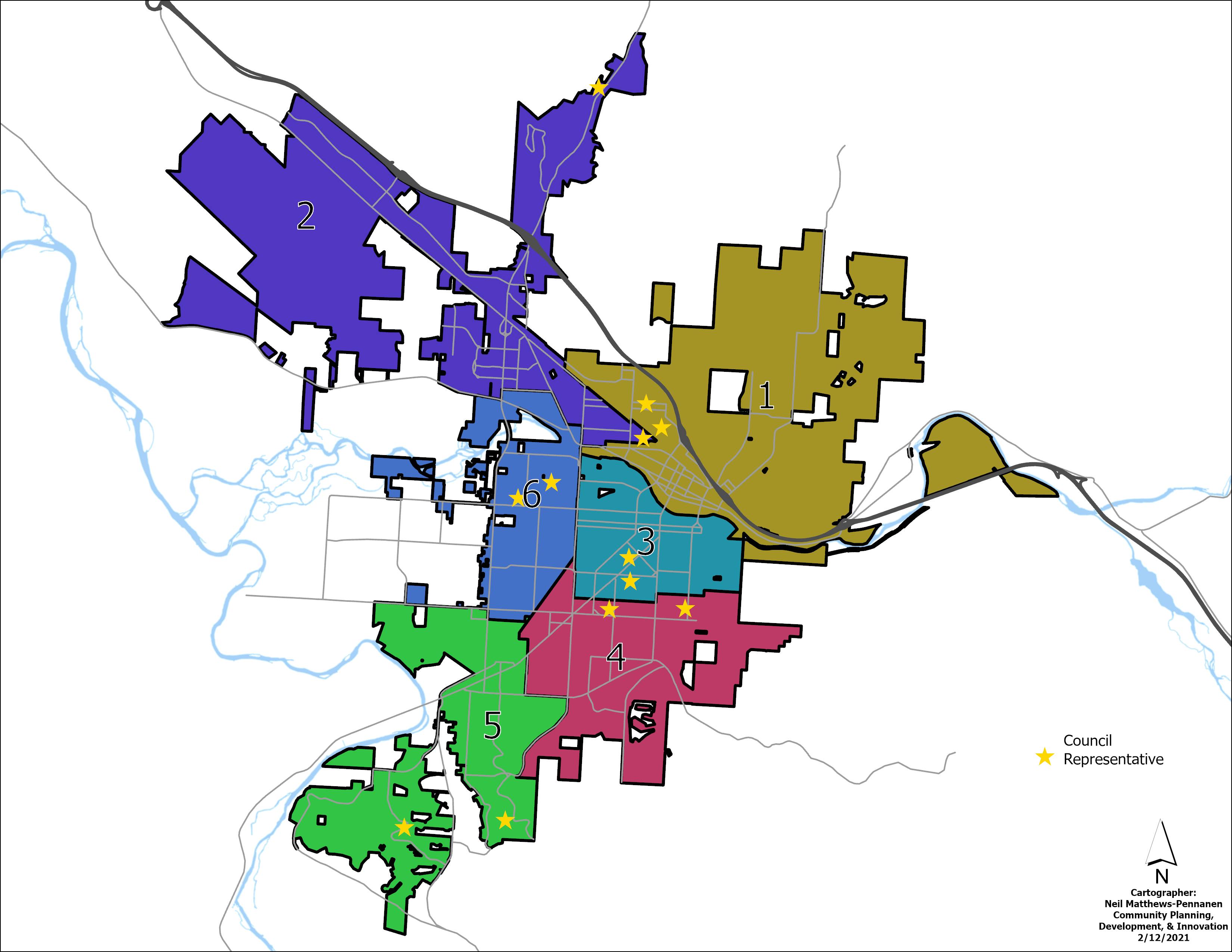
Current Ward Map

Estimated Population by Ward
Ward | 2021 Housing Units | 2021 Est. Population | Est. Change in Population (2019-2020) | # People from Average (13,063) | % People from Average | Aligned? |
1 | 6,805 | 13,066 | 236 | 3 | 0.02% | Yes |
2 | 6,748 | 13,800 | 979 | 737 | 5.6% | Over |
3 | 5,266 | 12,537 | 102 | -526 | -4.0% | Under |
4 | 5,854 | 12,533 | 51 | -530 | -4.0% | Under |
5 | 5,492 | 13,482 | 418 | 419 | 3.2% | Over |
6 | 6,435 | 12,958 | 259 | -105 | -0.8% | Yes |
Total | 36,600 | 78,376 | 2,045 |
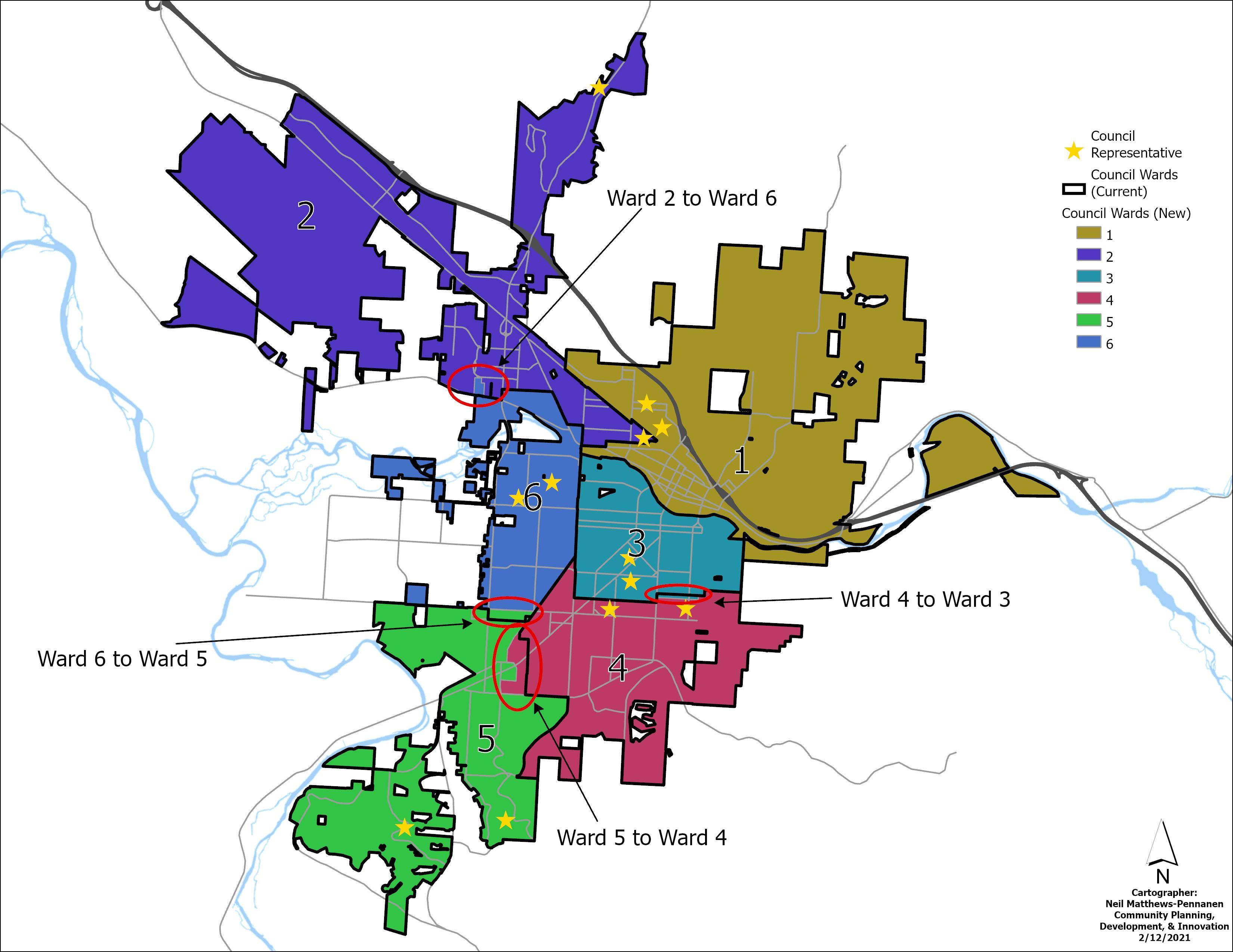
Overview of Changes in Preferred Option - In order to align the ward populations so they are each practically equal, four changes are proposed to the current ward boundaries. These changes are shown in the maps below.
Preferred Option Detailed Changes - Each of the following maps shows specific proposed changes from one ward to another. The proposed change areas are shown in a lighter color.
New Ward Map

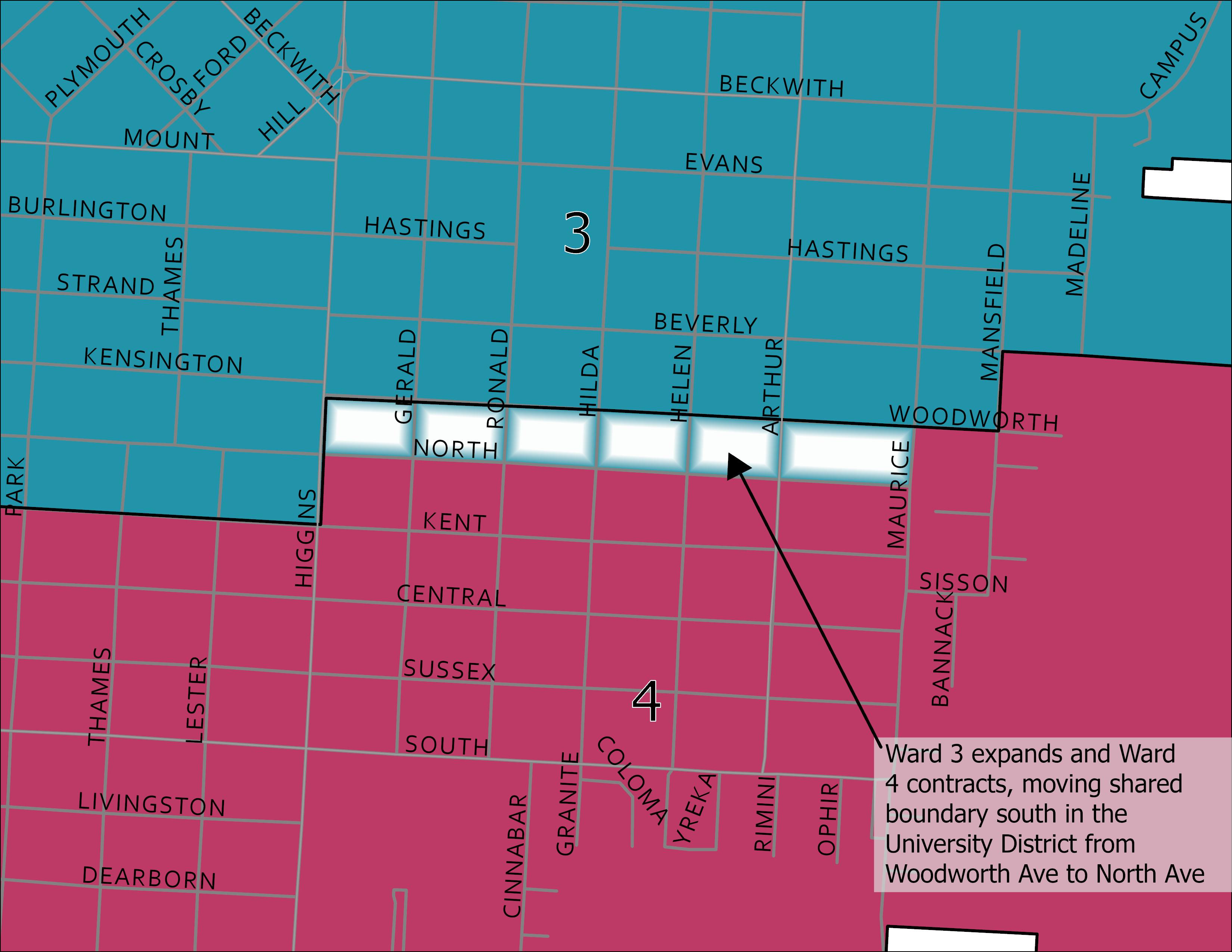
Ward 4 to Ward 3 Change

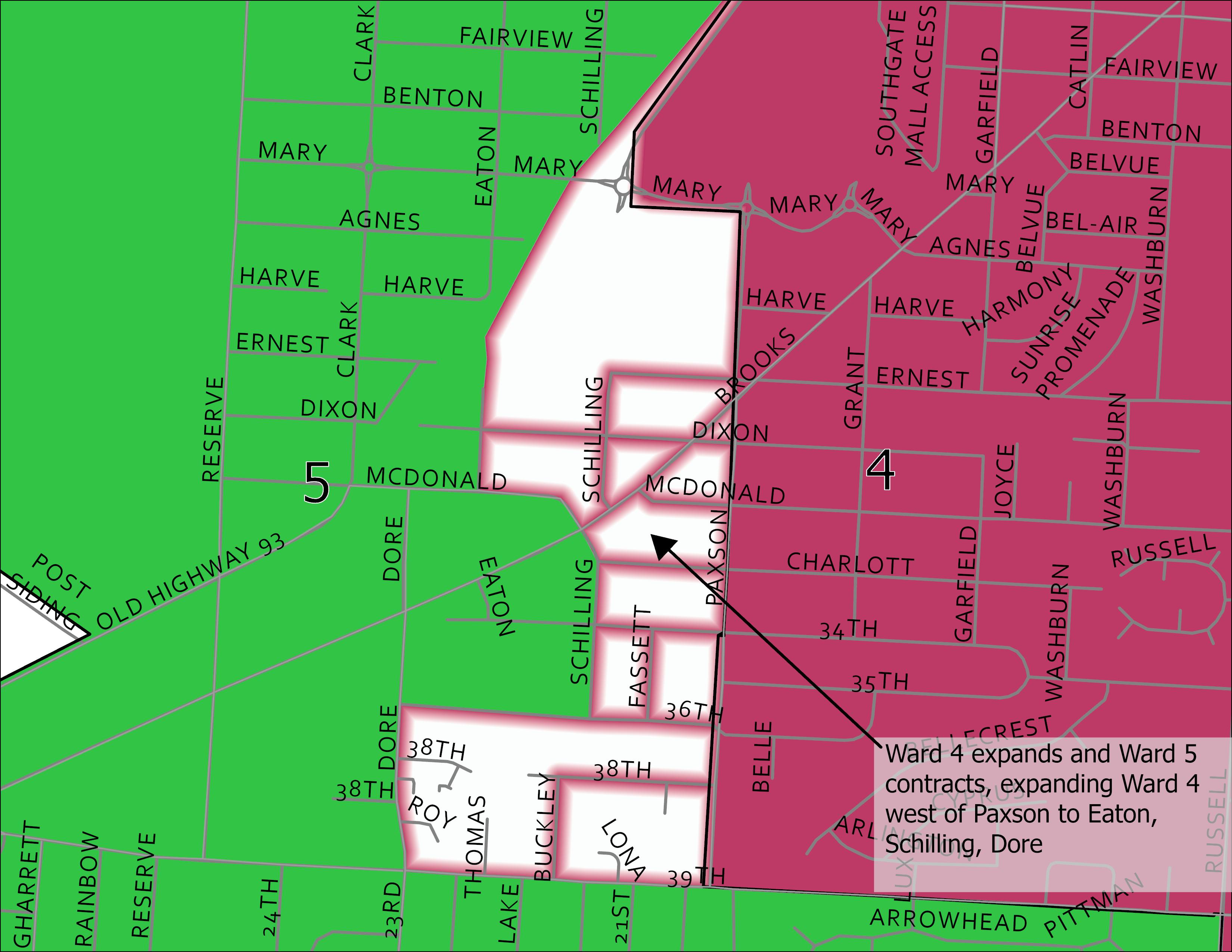
Ward 5 to Ward 4 Change

Ward 6 to Ward 5 Change

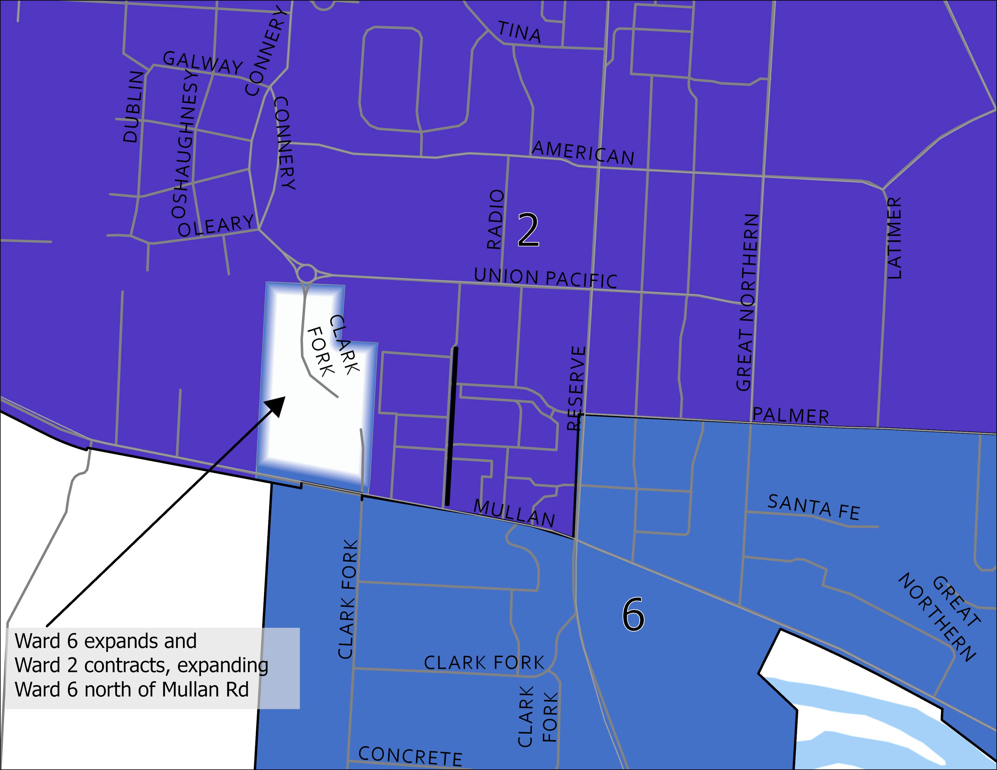
Ward 2 to Ward 6 Change

For more details on the process, please see the slides from the presentation to the Committee of the Whole from February 17, 2021.