Category Annexation Show all
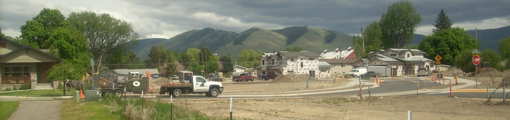
-
Annexation & Rezoning: Tract 1 of Certificate of Survey No. 5023
Share Annexation & Rezoning: Tract 1 of Certificate of Survey No. 5023 on Facebook Share Annexation & Rezoning: Tract 1 of Certificate of Survey No. 5023 on Twitter Share Annexation & Rezoning: Tract 1 of Certificate of Survey No. 5023 on Linkedin Email Annexation & Rezoning: Tract 1 of Certificate of Survey No. 5023 linkPROJECT DESCRIPTION:
Development Services received a petition from Andrew Bernard of Inland Group, on behalf of property owner Mullan Land Holding, LLC, requesting annexation into the City of Missoula of Tract 1 of Certificate of Survey No. 5023. The applicants also seek to amend an existing development agreement to allow the construction of a 170-unit multi-dwelling building and associated structures on that tract of land and on the surrounding Tract 4 of Certificate of Survey No. 6817. The 170-unit building is proposed to be a 55+ age-restricted residential community.
The property is located north of Mullan Road, east of Flynn Lane, and west of Mary Jane Boulevard. Both tracts are located in the NW ¼ of Section 18, Township 13 North, Range 19 West, Missoula County, Montana. Tract 1 is addressed as 2100 Flynn Lane. Tract 4 is addressed as 1955 Mary Jane Boulevard.
The property encompasses a total of 9 acres. Tract 1 of Certificate of Survey No. 5023 is currently zoned Neighborhood Residential in the County, with a land use designation in the 2045 Our Missoula City Growth Policy of Urban Mixed-Use Low. Upon annexation into the City of Missoula, the applicant has requested City zoning of B2-1 Community Business, which would match the surrounding property to the east, north, and south.
PROJECT APPLICATION LINKS:
The application packet can be viewed here: https://missoulaparks.org/3230/Private-Development-Projects
PROJECT TIMELINE:
City Council: April 7, 2025 at 6:00 p.m. – Consent Agenda. Adopt a Resolution of Intent to Annex, Set the Public Hearing, and Refer to the Land Use & Planning Committee.
Land Use and Planning Committee: April 16, 2025 (Time TBD) – Pre-public hearing informational item (no decision).
City Council: April 21, 2025, at 6:00 pm – Public Hearing and Final Consideration on a Resolution to Annex and Zone, and to Amend the Development Agreement.
All meetings will be held virtually, with more information to be posted here: https://www.ci.missoula.mt.us/1149/AgendasWebcastsMinutes(External link)
PROJECT COMMENT DEADLINE:
Public comment will be taken by City Council until the public hearings are closed. Comments can be submitted through Engage Missoula, via email to the planner noted below, by mailing in a letter to the City of Missoula office at 435 Ryman Street, Missoula, MT 59802, or during the public meetings. Provide your comment by Friday, March 28, 2025, to be included in the staff report provided to City Council. Your comments may be considered by City Council in the decision to approve or deny this request.
PROJECT PLANNER:
The project planner is Dave DeGrandpre, who can be reached at 406-552-6633 or degrandpred@ci.missoula.mt.us.
-
Annexation: 2812 & 2816 South 3rd Street W
Share Annexation: 2812 & 2816 South 3rd Street W on Facebook Share Annexation: 2812 & 2816 South 3rd Street W on Twitter Share Annexation: 2812 & 2816 South 3rd Street W on Linkedin Email Annexation: 2812 & 2816 South 3rd Street W linkPROJECT DESCRIPTION:
The City of Missoula is reviewing a petition from Jamie Erbacher of WGM Group, on behalf of property owner Third Street Partners LLC, requesting annexation of 2812 & 2816 S 3rd St. W, legally described as Lot 8 of Floral Addition, Section 19, Township 13 North, Range 19 West, Missoula County, Montana, P.M.M., into the City of Missoula, and zoning upon annexation of B1-1 Neighborhood Business.
The lot encompasses 20,125 square feet (0.46 acres) and is currently zoned Citizen-Initiated Zoning District 13 (CZD13) in the County, with a land use designation in the ‘Our Missoula’ City Growth Policy of Neighborhood Mixed Use. Upon annexation into the City of Missoula, the applicant has requested City zoning of B1-1 Neighborhood Business which is identified as a relatable zoning district under the Growth Policy. The B1-1 zoning district has no setbacks when the property is not abutting a residential zoning district. The subject property does abut a residential zoning and setbacks apply subject to Title 20, Section 20.10.030. The maximum allowed height is 40 feet unless abutting residential. The subject property abuts a residential zoning district and is therefore subject to Title 20, Section 20.10.030. The B1-1 zoning district allows for residential and commercial development and would allow 20 dwelling units to be developed on the subject property.
PROJECT APPLICATION LINKS:
The application packet can be viewed here: https://www.ci.missoula.mt.us/3230/Private-Development-Projects
PROJECT TIMELINE:
City Council: Monday, January 6, 2024, at 6:00 p.m. - Adopt Resolution of Intent, Set Public Hearing and Refer to LUP on Consent Agenda.
Land Use and Planning Committee: Wednesday, January 15, 2024 (Time TBD) – Informational item.
City Council: Monday, January 27, 2024, at 6:00 pm – City Council Public Hearing and Final Consideration on Resolution to Annex
All meetings will be held in a hybrid format. To attend the City Council public hearing in person, please go to Council Chambers at 140 W. Pine Street. To attend virtually via Microsoft TEAMS, more information on how to attend will be posted here: https://www.ci.missoula.mt.us/1149/AgendasWebcastsMinutes(External link)
PROJECT COMMENT DEADLINE:
Public comment will be taken by City Council until the public hearings are closed. Comments can be submitted through Engage Missoula, via email to the planner noted below, by mailing in a letter to the City of Missoula office at 435 Ryman Street, Missoula, MT 59802, or during the public meetings. Provide your comment by Tuesday, December 31, 2024, to be included in the staff report provided to City Council. Your comments may be considered by City Council in their decision to approve or deny this request.
PROJECT PLANNER:
The project planner is Charlie Ream. They can be reached at 406-552-6351 or reamc@ci.missoula.mt.us.
-
Annexation: 3300 Raser Drive
Share Annexation: 3300 Raser Drive on Facebook Share Annexation: 3300 Raser Drive on Twitter Share Annexation: 3300 Raser Drive on Linkedin Email Annexation: 3300 Raser Drive linkPROJECT DESCRIPTION:
Development Services received a petition from Jamie Erbacher of WGM Group, on behalf of property owner Roseburg Resources Co., requesting annexation into the City of Missoula and zoning upon annexation of Tracts 1, 3, 6, and 13 of Certificate of Survey No. 6982 and Tracts 2A, 4A, 5A, and 7A – 12A of Certificate of Survey No. 6695, all located in Sections 8 and 9, Township 13 North, Range 19 West, Missoula County, Montana. The property is addressed as 3300 Raser Drive. It is the location of the former Roseburg Forest Products particleboard plant adjacent and southwest of Interstate 90.
The property encompasses a total of 235 acres and is currently zoned Industrial Heavy Center in the County, with land use designations in the ‘Our Missoula’ City Growth Policy of Industrial Heavy and Industrial Light. Upon annexation into the City of Missoula, the applicant has requested City zoning of M1-2 Limited Industrial.
PROJECT APPLICATION LINKS:
The application packet can be viewed here: https://www.ci.missoula.mt.us/DocumentCenter/View/73610/Annexation-Submittal-3300-Raser-Dr-Roseburg-Resources-Co
PROJECT TIMELINE:
City Council: January 6, 2025 at 6:00 p.m. Adopt Resolution of Intent to Annex, Set Public Hearing, and Referral to LUP on Consent Agenda.
Land Use and Planning Committee: January 8, 2025 (Time TBD) – Pre-public hearing informational item.
City Council: January 27, 2025, at 6:00 pm – Public Hearing and Final Consideration on Resolution to Annex and Zone.
All meetings will be held virtually, with more information to be posted here: https://www.ci.missoula.mt.us/1149/AgendasWebcastsMinutes(External link)
PROJECT COMMENT DEADLINE:
Public comment will be taken by City Council until the public hearings are closed. Comments can be submitted through Engage Missoula, via email to the planner noted below, by mailing in a letter to the City of Missoula office at 435 Ryman Street, Missoula, MT 59802, or during the public meetings. Provide your comment by Monday, January 20, 2025, to be included in the staff report provided to City Council. Your comments may be considered by City Council in their decision to approve or deny this request.
-
Annexation: 2512 Olofson Dr
Share Annexation: 2512 Olofson Dr on Facebook Share Annexation: 2512 Olofson Dr on Twitter Share Annexation: 2512 Olofson Dr on Linkedin Email Annexation: 2512 Olofson Dr linkCLOSED: This discussion has concluded.UPDATE: This project has been postponed.
PROJECT DESCRIPTION:
The City of Missoula is reviewing a petition from Jamie Erbacher of WGM Group, on behalf of property owner Perry Ashby, requesting annexation of 2512 Olofson, legally described as Lot E of Orchard Homes, Section 19, Township 13 North, Range 19 West, Missoula County, Montana, P.M.M., into the City of Missoula, and zoning upon annexation of C1-3 Neighborhood Commercial with Design Excellence Overlay - Corridor Typology 4.
The lot encompasses 27,312 square feet (0.63 acres) and is currently zoned “Neighborhood Center” in the County, with a land use designation in the ‘Our Missoula’ City Growth Policy of Community Mixed Use. Upon annexation into the City of Missoula, the applicant has requested City zoning of C1-3 Neighborhood Commercial with Design Excellence Overlay - Corridor Typology 4 which is identified as a relatable zoning district under the Growth Policy. The C1-3 zoning district has no setbacks when the property is not abutting a residential zoning district. There is a residential zoning district abutting the northern boundary of the subject property and setbacks may apply subject to Title 20, Section 20.10.030. The maximum allowed height is 65 feet unless abutting residential. The subject property abuts a residential zoning district to the north and is therefore subject to Title 20, Section 20.10.030. The C1-3 zoning district allows for residential and commercial development and would allow 27 dwelling units to be developed on the subject property.
PROJECT APPLICATION LINKS:
The application packet can be viewed here: https://www.ci.missoula.mt.us/3230/Private-Development-Projects
PROJECT TIMELINE:
City Council: Monday, August 5, 2024, at 6:00 p.m. - Adopt Resolution of Intent, Set Public Hearing and Refer to LUP on Consent Agenda.
Land Use and Planning Committee: Wednesday, August 21, 2024 (Time TBD) – Informational item.
City Council: Monday, August 26, 2024, at 6:00 pm – City Council Public Hearing and Final Consideration on Resolution to Annex
All meetings will be held in a hybrid format. To attend the City Council public hearing in person, please go to Council Chambers at 140 W. Pine Street. To attend virtually via Microsoft TEAMS, more information on how to attend will be posted here: https://www.ci.missoula.mt.us/1149/AgendasWebcastsMinutes(External link)
PROJECT COMMENT DEADLINE:
Public comment will be taken by City Council until the public hearings are closed. Comments can be submitted through Engage Missoula, via email to the planner noted below, by mailing in a letter to the City of Missoula office at 435 Ryman Street, Missoula, MT 59802, or during the public meetings. Provide your comment by Wednesday, August 14, 2024, to be included in the staff report provided to City Council. Your comments may be considered by City Council in their decision to approve or deny this request.
PROJECT PLANNER:
The project planner is Charlie Ream. They can be reached at 406-552-6351 or reamc@ci.missoula.mt.us.
-
Subdivision, Annexation, & Rezone: Wildroot
Share Subdivision, Annexation, & Rezone: Wildroot on Facebook Share Subdivision, Annexation, & Rezone: Wildroot on Twitter Share Subdivision, Annexation, & Rezone: Wildroot on Linkedin Email Subdivision, Annexation, & Rezone: Wildroot linkCLOSED: This discussion has concluded.UPDATE: This project was approved on September 9, 2024. This case is now closed for comment.
PROJECT DESCRIPTION:
Development Services received a request from Cushing Terrell, on behalf of Pando Holdings, for a phased 248-lot major subdivision, annexation of 41.34 acres, and rezoning of the property located at and nearby 1600 Rimel Rd in Missoula adjacent to Hillview Way. Once complete, the subdivision would contain 21 townhome lots, 226 single-family lots, and 1 multi-family lot with 203 units. The property consists of 106.6 acres within seven parcels, two of which are already within City limits and five parcels to be annexed as a part of this proposal. The legal description can be summarized as seven tracts of land in the southwest quarter of the southwest quarter of Section 5 and the southeast quarter of Section 6, Township 12 North, Range 19 West, P.M.M. Missoula County, Montana.
The property abuts either existing residential development (generally to the west) or residential zoning (generally vacant at this time to the east) on all sides and one religious assembly use to the south. Another upcoming subdivision proposal, Meadow View Homes, is located nearby at the northwest corner across Hillview Way. The property was historically used for pasture grazing and a single-family home on site will be removed as a part of the proposal.
The proposed design is broken into 7 phases and improvements include the extension of a new collector road off Rimel Road, new water and sewer infrastructure, additional parkland, trail connections, and improvements to Hillview Way. The first phase of the proposed subdivision is the multi-family development currently permitted and under construction at the southwest parcel of the project area off Hillview Way.
The two parcels currently located within Missoula city limits are zoned a mix of RM1-35 Residential (multi-dwelling), RM0.5 Residential (multi-dwelling), R8 Residential, and B2-1 Community Business. The Hillview Heights Overlay also encompasses a portion of the western part of the site. The five parcels currently located in the County are zoned Residential (R) under Missoula County Zoning Regulations.
The proposed zoning for the site includes RM0.5 Residential (multi-dwelling), RM1-35 Residential (multi-dwelling), and R5.4 Residential. The proposal also requests the removal of the Hillview Heights overlay. The requested rezone is proposed to remove split-zoning currently in place on the property and to provide appropriate zoning for the future proposed residential development with higher density development located closer to Hillview Way and single-family uses as the site moves east and steepens.
The proposed zoning designations allow for a wide range of housing types including multi-dwelling buildings, townhomes, and single-family residences. The City’s Our Missoula Growth Policy identifies land use designations for the property of Residential High Density (24 – 43 dwelling units per acre) on the west side of the subject property and Residential Medium Density (3 – 11 dwelling units per acre) as you move east across the site. If developed as proposed, the subdivision would result in an overall density of just over 4 dwelling units per acre, which aligns with the general intent set forth in the Growth Policy, especially given that the proposal calls out higher density development to the west along Hillview Way and less dense development moving east, which upholds with Growth Policy recommendations.
The subdivision includes 7.8 acres of dedicated parkland that includes a new 8-foot wide gravel path connecting Moose Can Gully Trail to Rimel Road and an extensive network of less invasive singletrack
trails. In addition to parkland, 21.9 acres of common area would be accessible to residents and the public. The common areas are integrated into the overall layout of residential lots, providing additional trail connections throughout the neighborhood.
The subdivision includes six variance requests from the City Subdivision Regulations relating to allowing one dead-end street, exceeding block lengths in three different areas, accepting a trail alignment along Rimel Rd not fully meeting street/sidewalk standards, and permitting alleys to provide primary vehicular access to five lots.
PROJECT APPLICATION LINKS:
The application, preliminary plat, and other materials can be viewed here: https://www.ci.missoula.mt.us/3308/Wildroot-Subdivision
PROJECT TIMELINE:
· City Council Consent Agenda: August 19, 2024 at 6:00 PM – Resolution of intent to annex, first reading of a zoning ordinance, refer the item to the Land Use and Planning Committee, and set a Public Hearing.
· Planning Board: August 20, 2024 at 6:00 PM – Planning Board (City/County) Public Hearing
· Land Use and Planning Committee: August 28, 2024 at TBD – Informational Item (no decision)
· City Council: September 9, 2024 at 6:00 PM – City Council Public Hearing and Decision
All meetings will be held in a hybrid format, with the option to attend in-person or virtually via Microsoft TEAMs videoconferencing. To attend remotely, TEAMs links will be available on meeting agendas at the time of posting.
The Planning Board public hearing will be held in the Sophie Moiese conference room in the Missoula County Courthouse (200 W Broadway St.) Planning Board meeting agendas and information will be posted here: https://missoulacomt.portal.civicclerk.com/?category_id=33
City Council meetings will be held in City Council Chambers (140 W Pine St.) Meeting agendas and information will be posted here: https://www.ci.missoula.mt.us/1149/AgendasWebcastsMinutes
PROJECT COMMENT DEADLINE:
Public comment will be taken by City Council until the public hearings are closed. Comments can be submitted through Engage Missoula, via email to the planner noted below, by mailing in a letter to the City of Missoula Development Services office at 435 Ryman Street, Missoula, MT 59802, or during the public meetings. Provide your comment by Friday, August 9, 2024, to be included in the staff report provided to the Planning Board. Your comments will be considered by City Council in their decision to approve or deny this request.
PROJECT PLANNER: The project planner is Tara Porcari, who can be reached at porcarit@ci.missoula.mt.us.
REVIEW CRITERIA FOR ZONING AMENDMENTS (RE-ZONING):
City Council may either approve or deny the request. Standard zoning districts cannot be conditioned.
Title 20.85.040.G Review Criteria
In reviewing and making decisions on zoning amendments, the zoning officer, Planning Board and City Council must consider at least the following criteria:
1. Whether the proposed zoning amendment is consistent with MCA § 76-2-304:
a. Whether the zoning is made in accordance with a growth policy;
b. Whether the zoning is designed to secure safety from fire and other dangers;
c. Whether the zoning is designed to promote public health, public safety , and the general welfare;
d. Whether the zoning is designed to facilitate the adequate provision of transportation, water, sewerage, schools, parks, and other public requirements;
e. Whether the zoning considers the reasonable provision of adequate light and air;
f. Whether the zoning considers the effect on motorized and nonmotorized transportation systems;
g. Whether the zoning considers the promotion of compatible urban growth;
h. Whether the zoning considers the character of the district and its peculiar suitability for particular uses; and
i. Whether the zoning conserves the value of buildings and encourages the most appropriate use of land throughout the jurisdictional area.
2. Whether the proposed zoning amendment corrects an error or inconsistency in the zoning ordinance or meets the challenge of a changing condition;
3. Whether the proposed zoning amendment is in the best interests of the city as a whole.
Title 20.85.040.H Protest Provisions
1. A formal protest petition opposing a zoning amendment must be submitted to the zoning officer or on the public record before the City Council's vote, allowing sufficient time for the city clerk to determine the validity of the petition.
2. A protest petition will be considered "valid" if it is signed by the owners of 25% or more of:
a. The area of the parcels that are the subject of the proposed change; or
b. The parcels or units, as defined in MCA § 70-23-102, within 150 feet of the parcel that is the subject of the proposed change. The area per unit to be included in the calculation of the protest shall be determined per MCA § 76-2-305.
3. When a valid protest petition has been submitted, approval of a zoning amendment requires a two-thirds majority vote of those City Council members present and voting.
REVIEW CRITERIA FOR SUBDIVISIONS:
City Council may either approve, approve with conditions, or deny the request.
4-010.14.A. Prerequisites for Approval.
The City Council may not approve or conditionally approve a subdivision application and preliminary plat unless the proposed subdivision:
· Provides easements for the location and installation of any planned utilities;
· Provides legal and physical access to each parcel within the subdivision and the notation of that access on the applicable plat and any instrument transferring the parcel;
· Assures that all required public improvements will be installed before final plat approval, or that such installation after final plat approval will be guaranteed as provided by Article 5 of the subdivision regulations; and
· Will comply with the requirements of Montana Code Annotated 76-3-504 regarding the disclosure and disposition of water rights.
4-010.14.B. Consideration - Standards.
In approving, conditionally approving or denying a subdivision application and preliminary plat, the City Council must consider whether the proposed subdivision complies with:
· The City of Missoula Subdivision Regulations including but not limited to the design standards set forth in Article 3;
· Applicable zoning regulations;
· Any other applicable local, state, and federal regulations; and
· The Montana Subdivision and Planning Act, including but not limited to the following impacts:
o Impact on agriculture;
o Impact on agriculture water user facilities;
o Impact on local services;
o Impact on the natural environment;
o Impact on wildlife;
o Impact on wildlife habitat; and
o Impact on public health and safety.
-
Subdivision, Annexation & Rezoning: Aspire Subdivision 110 Sommers Street
Share Subdivision, Annexation & Rezoning: Aspire Subdivision 110 Sommers Street on Facebook Share Subdivision, Annexation & Rezoning: Aspire Subdivision 110 Sommers Street on Twitter Share Subdivision, Annexation & Rezoning: Aspire Subdivision 110 Sommers Street on Linkedin Email Subdivision, Annexation & Rezoning: Aspire Subdivision 110 Sommers Street linkCLOSED: This discussion has concluded.Update: This subdivision, annexation, and rezoning was approved on August 26, 2024.
PROJECT DESCRIPTION:
Development Services received a request from 406 Engineering, Inc., on behalf of Denova Northwest, for annexation of 35.28 acres of land, a 182-lot major subdivision, and rezoning located at 110 Sommers Street in East Missoula. The property abuts existing residential development to the west and north, the Clark Fork River to the east, and Interstate 90 to the south. It was historically used for agriculture and includes two residences and a kennel that are no longer occupied.
The property consists of eight existing tracts of record described as Tracts 1, 2, 3, 4, and 5 of Certificate of Survey No. 6629, Tracts 7 and 8 of Certificate of Survey No. 5298, and Tract A of Certificate of Survey No. 6338, all located in Section 19, Township 13 North, Range 18 West and Section 24, Township 13 North, Range 19 West.
The property is currently located outside of Missoula city limits and is zoned Residential (R) in Missoula County. In conjunction with annexing the property into the City of Missoula, the proposal includes a request to zone the subject property to the City’s RT5.4 Residential 5.4 (two-unit/townhouse) and apply a new Aspire Neighborhood Character Overlay zoning district. The RT5.4 zoning district permits detached houses, lot-line houses, two-unit townhouses, and two-unit houses.
The Aspire Neighborhood Character Overlay would expand the allowed uses to include multi-dwelling buildings on 10 lots (Lots 58-67) near the southern boundary of the subdivision. The overlay would also reduce front, rear, and side building setbacks throughout the subdivision and increase the percentage of front yards that may be used for parking or vehicular use. The stated intent of the overlay is to allow the creation of a variety of housing options for varying income levels within a cohesive neighborhood in compliance with the Residential Medium Density (3 – 11 dwelling units per acre) land use designation on the property under the City’s 2035 Our Missoula Growth Policy. If developed as proposed, the subdivision would result in approximately 7 dwelling units per acre.
The subdivision includes two public park areas including a 2.4-acre linear park with an 8-foot wide pedestrian path proposed along the top of the Clark Fork River bank and a 1.73-acre park abutting the existing Missoula County Canyon View Park at the subdivision’s west boundary.
The subdivision includes eight variance requests from the City Subdivision Regulations relating to reduced street right-of-way widths, eliminating a sidewalk along one side of a street for 460 feet, extending the maximum block lengths in several locations, and allowing alleys to provide primary vehicular access to three lots.
PROJECT APPLICATION LINKS:
The application, preliminary plat, and other materials can be viewed here: https://www.ci.missoula.mt.us/3310/Aspire-Subdivision
PROJECT TIMELINE:
Developer Sponsored Neighborhood Meeting: June 27, 2024 6:00 – 7:30 PM at Mount Jumbo School
City Council Consent Agenda: July 15, 2024 at 6:00 PM – Resolution of intent to annex, first reading of a zoning ordinance, and refer the item to the City Council Land Use and Planning Committee
Planning Board: July 16, 2024 at 6:00 PM – Planning Board Public Hearing
Planning Board Continued: August 6, 2024 at 6:00 PM – Planning Board Public Hearing
Land Use and Planning Committee: August 7, 2024 at TBD – Informational Item (no decision)
City Council: August 12, 2024 at 6:00 PM – City Council Public Hearing
All meetings will be held in a hybrid format, with the option to attend in-person or virtually via Microsoft TEAMs.
The Planning Board public hearing will be held in the Sophie Moiese conference room in the Missoula County Courthouse (200 W Broadway St.) Planning Board meeting agendas and information will be posted here: https://missoulacomt.portal.civicclerk.com/?category_id=33
City Council meetings will be held in City Council Chambers (140 W Pine St.) Meeting agendas and information will be posted here: https://www.ci.missoula.mt.us/1149/AgendasWebcastsMinutes
PROJECT COMMENT DEADLINE:
Public comment will be taken by City Council until the public hearings are closed. Comments can be submitted through Engage Missoula, via email to the planner noted below, by mailing in a letter to the City of Missoula Development Services office at 435 Ryman Street, Missoula, MT 59802, or during the public meetings. Provide your comment by Tuesday July 9, 2024, to be included in the staff report provided to the Planning Board. Your comments will be considered by City Council in their decision to approve or deny this request.
PROJECT PLANNERs:
The project planners are Dave DeGrandpre, who can be reached at (406) 552-6633 or degrandpred@ci.missoula.mt.us and Kristin Spadafore, who can be reached at (406) 552-6152 or spadaforek@ci.missoula.mt.us.
REVIEW CRITERIA FOR ZONING AMENDMENTS (RE-ZONING):
City Council may either approve or deny the request. Standard zoning districts cannot be conditioned.
Title 20.85.040.G Review Criteria
In reviewing and making decisions on zoning amendments, the zoning officer, Planning Board and City Council must consider at least the following criteria:
- Whether the proposed zoning amendment is consistent with MCA § 76-2-304:
- Whether the zoning is made in accordance with a growth policy;
- Whether the zoning is designed to secure safety from fire and other dangers;
- Whether the zoning is designed to promote public health, public safety , and the general welfare;
- Whether the zoning is designed to facilitate the adequate provision of transportation, water, sewerage, schools, parks, and other public requirements;
- Whether the zoning considers the reasonable provision of adequate light and air;
- Whether the zoning considers the effect on motorized and nonmotorized transportation systems;
- Whether the zoning considers the promotion of compatible urban growth;
- Whether the zoning considers the character of the district and its peculiar suitability for particular uses; and
- Whether the zoning conserves the value of buildings and encourages the most appropriate use of land throughout the jurisdictional area.
- Whether the proposed zoning amendment corrects an error or inconsistency in the zoning ordinance or meets the challenge of a changing condition;
- Whether the proposed zoning amendment is in the best interests of the city as a whole.
Title 20.85.040.H Protest Provisions
- A formal protest petition opposing a zoning amendment must be submitted to the zoning officer or on the public record before the City Council's vote, allowing sufficient time for the city clerk to determine the validity of the petition.
- A protest petition will be considered "valid" if it is signed by the owners of 25% or more of:
- The area of the parcels that are the subject of the proposed change; or
- The parcels or units, as defined in MCA § 70-23-102, within 150 feet of the parcel that is the subject of the proposed change. The area per unit to be included in the calculation of the protest shall be determined per MCA § 76-2-305.
- When a valid protest petition has been submitted, approval of a zoning amendment requires a two-thirds majority vote of those City Council members present and voting.
REVIEW CRITERIA FOR SUBDIVISIONS:
City Council may either approve, approve with conditions, or deny the request.
4-010.14.A. Prerequisites for Approval.
The City Council may not approve or conditionally approve a subdivision application and preliminary plat unless the proposed subdivision:
- Provides easements for the location and installation of any planned utilities;
- Provides legal and physical access to each parcel within the subdivision and the notation of that access on the applicable plat and any instrument transferring the parcel;
- Assures that all required public improvements will be installed before final plat approval, or that such installation after final plat approval will be guaranteed as provided by Article 5 of the subdivision regulations; and
- Will comply with the requirements of Montana Code Annotated 76-3-504 regarding the disclosure and disposition of water rights.
4-010.14.B. Consideration - Standards.
In approving, conditionally approving or denying a subdivision application and preliminary plat, the City Council must consider whether the proposed subdivision complies with:
- The City of Missoula Subdivision Regulations including but not limited to the design standards set forth in Article 3;
- Applicable zoning regulations;
- Any other applicable local, state, and federal regulations; and
- The Montana Subdivision and Planning Act, including but not limited to the following impacts:
- Impact on agriculture;
- Impact on agriculture water user facilities;
- Impact on local services;
- Impact on the natural environment;
- Impact on wildlife;
- Impact on wildlife habitat; and
- Impact on public health and safety.
- Whether the proposed zoning amendment is consistent with MCA § 76-2-304:
-
Annexation: Lot 59 of U.S. Government Survey #2, Section 30, Township 13 North, Range 19 West, Missoula County, Montana, P.M.M.
Share Annexation: Lot 59 of U.S. Government Survey #2, Section 30, Township 13 North, Range 19 West, Missoula County, Montana, P.M.M. on Facebook Share Annexation: Lot 59 of U.S. Government Survey #2, Section 30, Township 13 North, Range 19 West, Missoula County, Montana, P.M.M. on Twitter Share Annexation: Lot 59 of U.S. Government Survey #2, Section 30, Township 13 North, Range 19 West, Missoula County, Montana, P.M.M. on Linkedin Email Annexation: Lot 59 of U.S. Government Survey #2, Section 30, Township 13 North, Range 19 West, Missoula County, Montana, P.M.M. linkCLOSED: This discussion has concluded.UPDATE: The annexation request was approved on June 10, 2024. This case is now closed for comment.
PROJECT DESCRIPTION:
The City of Missoula is reviewing a petition from Tamara Ross of IMEG Corp., on behalf of property owner Feist Limited Partnership, requesting annexation into the City of Missoula, and zoning upon annexation of B2-2 Community Business, for Lot 59 of U.S. Government Survey #2, Section 30, Township 13 North, Range 19 West, Missoula County, Montana, P.M.M.
The lot encompasses 43,212 square feet (2.10 acres) and is currently zoned “Neighborhood Center” in the County, with a land use designation in the ‘Our Missoula’ City Growth Policy of Community Mixed Use. Upon annexation into the City of Missoula, the applicant has requested City zoning of B2-2 Community Business which is identified as a relatable zoning district under the Growth Policy. The B2-2 zoning district has no setbacks, a height limit of 50 feet, and allows for residential and some commercial development. The B2-2 zoning district would allow 43 dwelling units to be developed on the subject property.
PROJECT APPLICATION LINKS:
The application packet can be viewed here: https://www.ci.missoula.mt.us/3230/Private-Development-Projects
PROJECT TIMELINE:
City Council: May 20, 2024, Adopt Resolution of Intent, Set Public Hearing and Refer to LUP on Consent Agenda.
Land Use and Planning Committee: June 5, 2024 (Time TBD) – Informational item.
City Council: June 10, 2024, at 6:00 pm – City Council Public Hearing and Final Consideration on Resolution to Annex
All meetings will be held virtually, with more information to be posted here: https://www.ci.missoula.mt.us/1149/AgendasWebcastsMinutes(External link)
PROJECT COMMENT DEADLINE:
Public comment will be taken by City Council until the public hearings are closed. Comments can be submitted through Engage Missoula, via email to the planner noted below, by mailing in a letter to the City of Missoula office at 435 Ryman Street, Missoula, MT 59802, or during the public meetings. Provide your comment by Thursday, May 14, 2024, to be included in the staff report provided to City Council. Your comments may be considered by Planning Board and City Council in their decision to approve or deny this request.
PROJECT PLANNER:
The project planner is Charlie Ream. They can be reached at 406-552-6351 or reamc@ci.missoula.mt.us.
-
Burns Addition (Lots 1-10) Annexation
Share Burns Addition (Lots 1-10) Annexation on Facebook Share Burns Addition (Lots 1-10) Annexation on Twitter Share Burns Addition (Lots 1-10) Annexation on Linkedin Email Burns Addition (Lots 1-10) Annexation linkCLOSED: This discussion has concluded.UPDATE: The annexation request was approved on December 11, 2023. This case is now closed for comment.
PROJECT DESCRIPTION:
The City of Missoula is reviewing a petition from James Sage of Missoula Engineering, LLC, on behalf of property owner Kirk Mace, requesting annexation into the City of Missoula, and zoning upon annexation of Lots 1-10 of the Burns Addition, Section 30, Township 13 North, Range 19 West, Missoula County, Montana (corner of 27th Ave and Central Ave).
Annexation was initially recommended by City staff when the applicant applied to the Utility Services Review Committee (USRC) for City water and sewer. As a result, the applicant has submitted their petition for annexation.
The 10 lots encompass a total of 91,442 square feet (2.10 acres) and include the following addresses: 2105 27th Ave., 2111 27th Ave., 2117 27th Ave., 2123 27th Ave., 2706 W. Central Ave., 2710 W. Central Ave., 2714 W. Central Ave., NKN Clar Drive, NKN Clar Drive, and NKN Clar Drive. It is currently zoned “Citizen Initiated Zoning District #12” in the County, with a land use designation in the ‘Our Missoula’ City Growth Policy of Residential Medium Density. Upon annexation into the City of Missoula, the applicant has requested City zoning of RT5.4 Residential 5.4 (two-unit/townhouse), which is identified as a relatable zoning district under the Growth Policy.
PROJECT APPLICATION LINKS:
The application packet can be viewed here: https://www.ci.missoula.mt.us/1638/Private-Development-Projects(External link)
PROJECT TIMELINE:
City Council: November 27, 2023, Adopt Resolution of Intent, Set Public Hearing and Referral to LUP on Consent Agenda.
City Council: December 4, 2023, at 6:00 pm – City Council public hearing.
Land Use and Planning Committee: December 6, 2023 (Time TBD) – Post-public hearing informational item.
City Council: December 11, 2023, at 6:00 pm – Final Consideration on Resolution to Annex
All meetings will be held virtually, with more information to be posted here: https://www.ci.missoula.mt.us/1149/AgendasWebcastsMinutes(External link)
PROJECT COMMENT DEADLINE:
Public comment will be taken by City Council until the public hearings are closed. Comments can be submitted through Engage Missoula, via email to the planner noted below, by mailing in a letter to the City of Missoula office at 435 Ryman Street, Missoula, MT 59802, or during the public meetings. Provide your comment by Monday, November 20, 2023, to be included in the staff report provided to City Council. Your comments may be considered by Planning Board and City Council in their decision to approve or deny this request.
PROJECT PLANNER:
The Project Planner is Tara Porcari. They can be reached at 406-552-6085 or porcarit@ci.missoula.mt.us.
-
Subdivision and Annexation: Sapphire Place
Share Subdivision and Annexation: Sapphire Place on Facebook Share Subdivision and Annexation: Sapphire Place on Twitter Share Subdivision and Annexation: Sapphire Place on Linkedin Email Subdivision and Annexation: Sapphire Place linkCLOSED: This discussion has concluded.UPDATE: The annexation and subdivision preliminary plat were approved by City Council on June 26th, 2023. This case is now closed for comment.
PROJECT DESCRIPTION:
Development Services has received a request from IMEG Corp., on behalf of Cathcart Properties Inc., for a 39-lot major residential subdivision and annexation of 18 acres located west of Flynn Lane on Tract 2-A of Certificate of Survey No. 6689. The proposed subdivision is named Sapphire Place.
The project is within the Sxwtpqyen Neighborhoods Master Plan area and must comply with the Sxwtpqyen Neighborhoods Form Based Zoning Code (Title 21). Title 21 Form Based Zoning Code regulates street types, block perimeters, minimum and maximum densities, lots sizes, ratio of zoning districts (transect zones), land uses, design and more. Title 21 requires that City Council either approve, approve with conditions, or deny the master site plan.
To comply with the Form Based Zoning Code, the applicant requests zoning upon annexation of Title 21 transect zones: OS Open Space (2.6 acres), T3 Neighborhood Edge (1.06 acres), T4-O Neighborhood General – Open (4.56 acres), T4-R Neighborhood General – Restricted (1.92 acres) and T5 Mixed-Use Center(3.71 acres). The T3 transect zone primarily permits residential uses at a density of 6 to 8 dwelling units per acre, some civic uses, and some educational uses. The T4-R transect zone primarily permits residential uses at a density of 12 to 36 dwelling units per acre, some civic, and some educational uses. The T4-O transect zone primarily permits residential uses at 12 to 36 dwelling units per acre, small scale lodging, commercial, some civic, and some educational uses. The T5 zone permits residential uses at 24 to 72 units per acre, the highest intensity and mix of uses with buildings located close to the sidewalk. The applicant is proposing to preserve historic buildings onsite and to dedicate parkland equivalent to 2.2 acres.
The applicant is requesting variances to Article 3, Section 3-030.1.C.3 of the City Subdivision Regulations which requires each lot to abut and have access to a public or private street or road.
PROJECT APPLICATION LINKS:
The application, preliminary plat, and other materials can be viewed here: https://www.ci.missoula.mt.us/3114/Sapphire-Place-Subdivision
PROJECT TIMELINE:
City Council: June 5th, 2023 at 6:00pm – Adopt Resolution of Intent to Annex, set the City Council Public Hearing, and referral to Land Use and Planning Committee
Planning Board: June 6th, 2023 at 6:00pm – Public hearing
Land Use and Planning Committee: June 7th, 2023 (Time TBD) Pre-public hearing informational only meeting
City Council: June 12th, 2023, at 6:00pm – City Council public hearing
Land Use and Planning Committee: June 21st, 2023 (time TBD) – Discussion and Motions
City Council: June 26th, 2023 at 6:00 pm – Final Consideration
PROJECT COMMENT DEADLINE:
Public comment will be taken by City Council until the public hearings are closed. Comments can be submitted through Engage Missoula, via email to the planner noted below, by mailing in a letter to the City of Missoula office at 435 Ryman Street, Missoula, MT 59802, or during the public meetings. Provide your comment by May 30, 2023 be included in the staff report provided to Planning Board and City Council. Your comments may be considered by City Council in their decision to approve or deny this request.
PROJECT PLANNER:
The project planner is Dave DeGrandpre who can be reached at (406) 529-0709 or degrandpred@ci.missoula.mt.us.
Comments may also be submitted on this page, by email to degrandpred@ci.missoula.mt.us, or by mail to Development Services, Attn: Dave DeGrandpre at 435 Ryman Street, Missoula, Montana, 59802. Written comment will be taken up until the public hearing is closed.
REVIEW CRITERIA FOR ANNEXATION
Review the City Annexation Policy here: https://www.ci.missoula.mt.us/1506/Plans-and-Regulations
REVIEW CRITERIA FOR SUBDIVISIONS
4-010.14.A. Prerequisites for Approval.
- The City Council may not approve or conditionally approve a subdivision application and preliminary plat unless the proposed subdivision:
- Provides easements for the location and installation of any planned utilities;
- Provides legal and physical access to each parcel within the subdivision and the notation of that access on the applicable plat and any instrument transferring the parcel;
- Assures that all required public improvements will be installed before final plat approval, or that such installation after final plat approval will be guaranteed as provided by Article 5 of the subdivision regulations; and
- Will comply with the requirements of Montana Code Annotated 76-3-504 regarding the disclosure and disposition of water rights.
4-010.14.B. Consideration - Standards.
In approving, conditionally approving or denying a subdivision application and preliminary plat, the City Council must consider whether the proposed subdivision complies with:
- The City of Missoula Subdivision Regulations including but not limited to the design standards set forth in Article 3;
- Applicable zoning regulations;
- Any other applicable local, state, and federal regulations; and
- The Montana Subdivision and Planning Act, including but not limited to the following impacts
- Impact on agriculture;
- Impact on agriculture water user facilities;
- Impact on local services;
- Impact on the natural environment;
- Impact on wildlife;
- Impact on wildlife habitat; and
- Impact on public health and safety.
-
Annexation: Alisha Drive - Linda Vista
Share Annexation: Alisha Drive - Linda Vista on Facebook Share Annexation: Alisha Drive - Linda Vista on Twitter Share Annexation: Alisha Drive - Linda Vista on Linkedin Email Annexation: Alisha Drive - Linda Vista linkCLOSED: This discussion has concluded.UDPATE: On May 8, 2023 City Council approved the request to annex Tract 3 of C.O.S. Number 6355 into the Missoula City limits. This case is now closed for comment.
PROJECT DESCRIPTION:
The City of Missoula is reviewing a petition from Toby Dumont of Professional Consultants Inc., on behalf of property owner Scott Twite, requesting annexation into the City of Missoula in order to fulfill a condition of approval for a boundary line relocation at 6991 Alisha Drive. The 10.62 acres, legally described as a portion of Tract 3 of Certificate of Survey No. 6355, located in the Northeast one-quarter of Section 13, Township 12 North, Range 20 West, P.M.M., will be zoned Miller Creek View Addition Planned Unit Development upon annexation.
The parcel would be added to City Council Ward 5 and the Miller Creek Neighborhood Council.
PROJECT APPLICATION LINKS:
The application packet can be viewed here: https://www.ci.missoula.mt.us/1638/Private-Development-Projects(External link)
PROJECT TIMELINE:
City Council: April 17th, 2023 at 6:00 pm, Adopt Resolution of Intent to Annex, Set Public Hearing, and Referral to the City Council Land Use and Planning Committee on Consent Agenda.
City Council: Monday May 1st, 2023, at 6:00 pm – City Council public hearing.
Land Use and Planning Committee: Wednesday May 3rd, 2023 (Time TBD) – Post-public hearing informational item.
City Council: Monday May 8th, 2023, at 6:00 pm – Final Consideration on Resolution to Annex
All meetings will be held in person at City Council Chambers at 140 W. Pine Street and virtually online, with more information to be posted here: https://www.ci.missoula.mt.us/1149/AgendasWebcastsMinutes(External link)
PROJECT COMMENT DEADLINE:
Public comment will be taken by City Council until the public hearings are closed. Comments can be submitted through Engage Missoula, via email to the planner noted below, by mailing in a letter to the City of Missoula Development Services office at 435 Ryman Street, Missoula, MT 59802, or during the public meetings. Provide your comment by Wednesday, April 5th, 2023, to be included in the staff report provided to City Council. Your comments will be considered by City Council in the decision to approve or deny this request.
PROJECT PLANNER:
The project planner is Tara Porcari. They can be reached at 406-552-6085 or porcari@ci.missoula.mt.us.