
Clark Fork River Restoration & Access Project
Project Overview
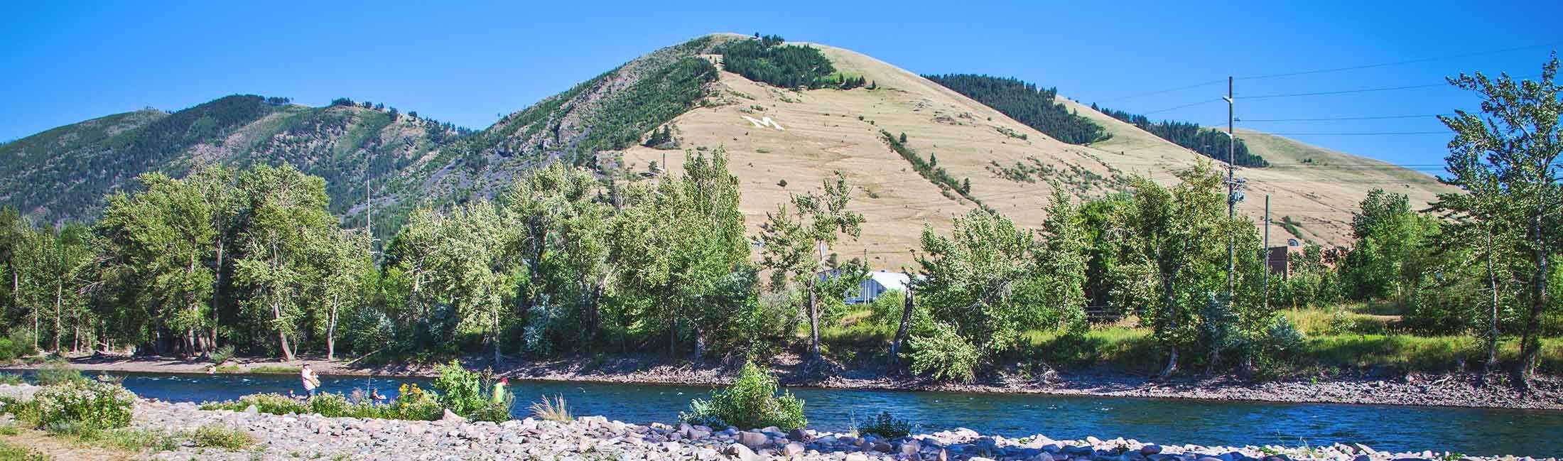
The Clark Fork River Restoration and Access Project addresses the need for better, more sustainable user access to the river and seeks to balance river recreation with river ecosystem health and restoration. The project area includes specific sites along the north and south banks of the Clark Fork River for the 4-mile stretch in Missoula between Riverside Park just west of Russell Street and Ben Hughes Park in East Missoula. Implementation will be phased over time, with the initial phase addressing the most heavily impacted areas.
Project Update – December 2025
Phase 2 of the Clark Fork River Access Project began the week of July 14, 2025, and was finished on November 11, 2025, completing construction of four designated river access sites and five restoration sites on the south side of the Clark Fork River adjacent the Milwaukee Trail.
| The Toole Park River Access site was the first project to be completed on the south side of the river. This access site provides a set of stairs for river access with terrace boulder seating. |  |
 |  | Bear Tracks River Access site was the second project to be completed. This river access site reconstructed an eroding riverbank with access stairs, two natural surface viewing areas and rock terrace seating that reflects a natural riverbank. In addition, the Milwaukee shared-use path was separated from the river access path to decrease user congestion. |
| Toole Park West River Access and East Access were the last two constructed sites. These sites serve as a dedicated river access site with a set of stairs. |  |  |
Project Facts:
Bear Tracks River Access cost: ~ $289,421
Toole Park River Access (3 sites) cost: ~ $178,091
Site Restoration (includes fencing): ~ $93,089
2,638 liner feet of fencing installed
60 flat stone stairs installed
~ 90 days to complete work
Work to be completed:
As conditions allow, Spring of 2026 construction will begin on the Madison Bridge River access site with the intent of having it complete for the 2026 summer season.
Parks and Recreation staff to complete planting at river access sites and site restoration in 2026.
Project Update – July 2025
The City of Missoula and project partners were successful in completing the first portion of this project in late May/early June of 2025. The Caras Park access improvements (aka Caras Terrace) portion of the first project phase has been completed and a ribbon-cutting celebration was held on June 14, 2025.
 |  |  |
Additional Access Site Improvements
 The next part of this phase involves additional river access site improvements areas (shown in the map below). Work begins the week of July 14, 2025, when contractors install post and rail fence along the Milwaukee Trail between Beartracks Bridge and the Madison Street Bridge. River access work is scheduled to begin around the week of August 25 with substantial completion expected around January 1, 2026.
Upon project completion, there will be five improved river access sites and 19 restoration sites that will be protected by the new fencing. Each access point will be different so that they fit the surrounding environment.
Below are links to drawings for each planned site:
| Clark Fork River Access Points |
|---|
 Caras Park River Access Point (Caras Terrace)—Project Completed |
 Beartracks Bridge River Access Point (concept drawing) |
 Toole Park River Access Point (concept drawing) Toole Park River Access Point (concept drawing) |
  River Access Points Across from Toole Park (concept drawing) River Access Points Across from Toole Park (concept drawing) |
 Madison Street Bridge River Access Point (concept drawing) Madison Street Bridge River Access Point (concept drawing) |
What to expect during construction:
- Construction traffic and rolling shoulder closures on the Milwaukee Trail between Beartracks Bridge and Madison Street Bridge.
- Trail will remain open with a reduced travel lane width at shoulder closures.
- Construction staging and trail access at Beartracks under bridge.
- Fence openings will be maintained at the Toole Park sites to allow river access during construction.
Project Benefits
This phase of the project will:
- Balance river access with river ecosystem health and restoration.
- Prevent stream bank erosion from concentrated use.
- Improve the natural and beneficial functions of the riparian area.
- Support habitat and food for a diverse group of aquatic species and small wildlife.
- Provide shade that helps cool water temperatures.
Project Costs
This portion of the project is fully funded with 2018 Open Space bond funds that were approved by Council on February 5, 2024 (Resolution 8747). The project includes in-kind services estimated at a value of $50,000 for restoration planting. Project budget is $845,000 with a contract value of $676,892.
Project Cost Estimates and Funding for Entire Project
Estimated Project Budget/Costs | Amount | % of Total Cost | Status |
Engineering/Planning/Design/Survey | $ 301,288 | 10.4% | Completed |
Construction of River Restoration and Access Sites (South Bank and Madison Street) | $ 785,421 | 27.2% | Scheduled |
Caras Park River Access Improvements | $1,525,380 | 52.8% | Completed |
| Land Easements &/or Agreements | $90,000 (approx.) | 3% | Completed |
Construction Administration | $79,916 | 2.7% | Completed |
| Construction Contingency | $108,299 | 3.7% | Scheduled |
Total Estimated Project Costs | $2,890,304 |
|
Anticipated Funding Sources | Amount | % of Total Cost | Status |
City of Missoula Staff Time & Materials (grow and install plants, build fencing, signage, maintain restoration until established, etc.) | $45,000 | 1.6% | Committed |
City and Partner Volunteer Work | $10,000 | 0.3% | Committed |
Economic Development Administration (EDA) for Caras Park Improvements | $1,220,304 | 42% | Awarded |
Missoula Redevelopment Agency (MRA) | $100,000 | 3.4% | Awarded |
Downtown Missoula Partnership | $200,000 | 6.9% | Awarded |
| Easement Donation from Boone & Crocket Club | $90,000 (approx.) | 3% | Awarded |
2018 OS Bond 2018 undertaking (already allocated to design development) | $225,000 | 7.7% | Allocated |
2018 OPEN SPACE BOND - CITY | Not to exceed $1 Million | 34.6% | Allocated |
Total Anticipated Funds | $2,890,304 |
Background
 |  |  |
Humans have used and enjoyed the Clark Fork River for thousands of years. Native Americans relied on the river for transportation and food, especially for its unique abundance of Bull Trout. For most of the 19th and 20th centuries, the Clark Fork was a working river, supporting industry, transportation, agriculture, and mining, all of which left their mark on the river. As recently as the 1960s and 70s, the Clark Fork ran red with mining waste, even in Missoula, nearly 100 miles downstream of the mines in Butte. But times have changed. With the removal of Milltown Dam, cleanup of mining wastes, and dramatic improvements in water quality, the Clark Fork has undergone a renaissance. After many years of neglecting the Clark Fork, Missoula has turned to face the river, now considered one of our community’s greatest assets by residents and visitors alike.
A new potential threat has emerged from the city’s newfound love of the river. A dramatic increase in recreational use of the river, particularly through the urban stretch in Missoula, has created significant erosion problems. Boaters, tubers, fishermen, bathers, and people just wanting to get close to the water have worn in a network of informal user trails along the banks of the river. These trails have damaged riparian vegetation and caused erosion that is degrading water quality and threatens the stability of paved trails and other infrastructure near the river.

Goals — Full Project
- Inventory and monitor riverbank erosion and identify user-made access points along the river.
- Create/affirm site selection criteria for riverbank restoration and/or access enhancements.
- Design and construct an intuitive system of walk-in river access points for a variety of recreational users to encourage responsible recreation and promote the health and aesthetics of the Clark Fork River.
- Design and implement a restoration program to sustainably restore impacted riverbank locations throughout the project area and potentially beyond.
Public Engagement
This project builds upon years of research and planning, including river user surveys, ecological monitoring and inventory, preliminary restoration and access site selection criteria, and design concepts. The survey is now closed. We appreciate your feedback because will help guide the project and play a major part in its success.
Signup Banner

Who's Listening
-
Phone 406-552-6261 Email mcleodn@ci.missoula.mt.us

Project Design Drawings

Site Selection Criteria
Additional Background Information
-
 Additional Background Information
-
 Bank Erosion Report August 2020 (4.65 MB) (pdf)
-
Erosion Severity Map (5.61 MB) (pdf)
-
Missoula Downtown River Corridor Map (9.31 MB) (pdf)
-
Clark Fork River Sustainable Access Concept Plans April 2016 (8.65 MB) (pdf)
-
River Use Survey Report 2020 (1.36 MB) (pdf)
-
River User Survey Report 2015 (1.45 MB) (pdf)
-
-
CFR R&A Survey Results Spring 2021 (270 KB) (pdf)
-
2024-09-20 Caras Park river access project begins.pdf (140 KB) (pdf)


